blah blah blah
Lockes Hill
Length: 1.9-mile loopDifficulty (click for info): Easy
Elevation Gain: 470 feet (+20 feet on descent)
Rating (click for info): 6/10
Elevation: 1055'
Prominence: 266'
Driving Directions:
Trailhead and parking area are on Rt. 11 in Gilford, NH. Look for the entrance to the set-back parking lot on the southwest side of the road, 2.0 miles east of the traffic light at the intersection with Rt. 11B and 4.6 miles northwest of the eastern junction with Rt. 11A. It is just barely northwest of the long scenic overlook pull-off. Click here for a Google map.
About the Hike:
Despite being lower in altitude than a nearby neighborhood, Lockes Hill offers a brief but vigorous hike that takes in fine views over Lake Winnipesaukee. In a chain of small hills extending north from the Belknep Range, Lockes Hill slopes right up from the shore of the lake at a peninsula called Belknap Point, surrounded by community docks and lakeside resort properties. With the well-used and rocky loop trail that crosses its summit, comparisons arise to the hike over Mt. Major, of which it resembles a miniature version with less difficulty but also less scenery. Multiple viewpoints along the way break up the hike, which starts with a steeper climb to the top of the hill and ends wtih a longer and mellower descent through easier terrain.
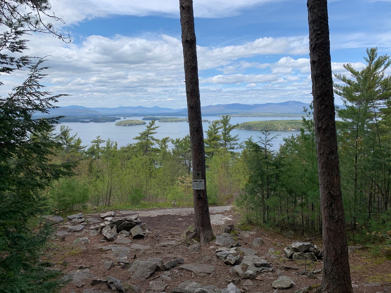
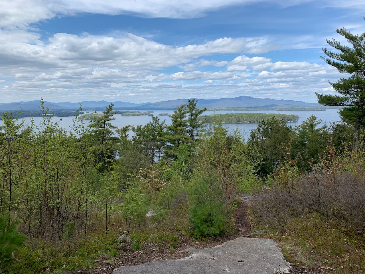
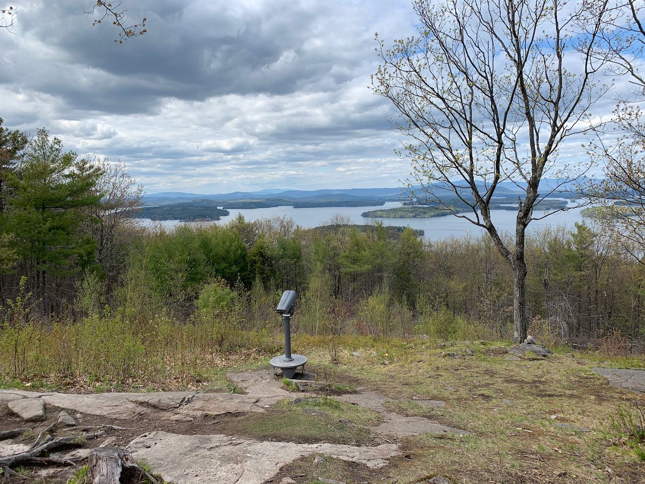
Start your hike on the right side of the parking area, on the Lakeview Trail. The trail ascends through the woods parallel to the road for 0.15 miles on a well-trodden surface with some stonework underfoot. It then enters a hemlock forest and makes rapid switchbacks uphill for another 0.15 miles. After many turns it heads straight across the slope, ascending and then dropping slightly to reach a clearing named "The Glade" with great views over the lake after another 0.1 miles. This spot has wide views over the lake that takes in its many islands, including Welch Island, the nearest. Behind this is the long, tapering form of the Ossipee Range, on the right side of the view. To the left is the Sandwich Range of the White Mountains. Mt. Washington can be seen rising behind the far right side of these mountains. In front of them on the left, you can see Red Hill, situated in between Lake Winnipesaukee and Squam Lake. Enjoy the scenery here for a while before continuing on. The trail crosses easier terrain through sparse trees for 0.2 miles, then climbs past a conspicuous boulder and emerges in the meadow-like clearing around the summit of the hill.
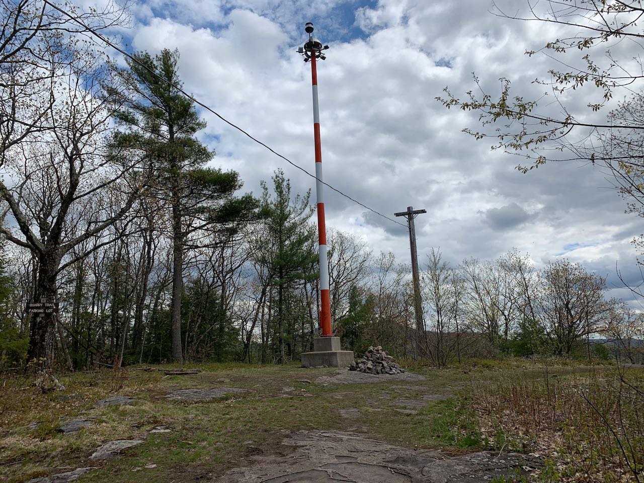
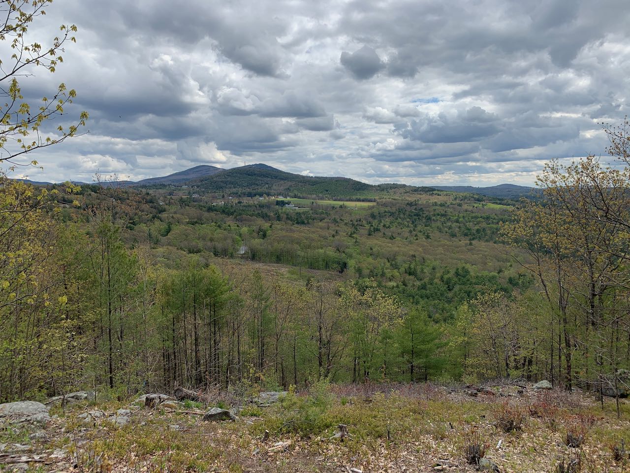
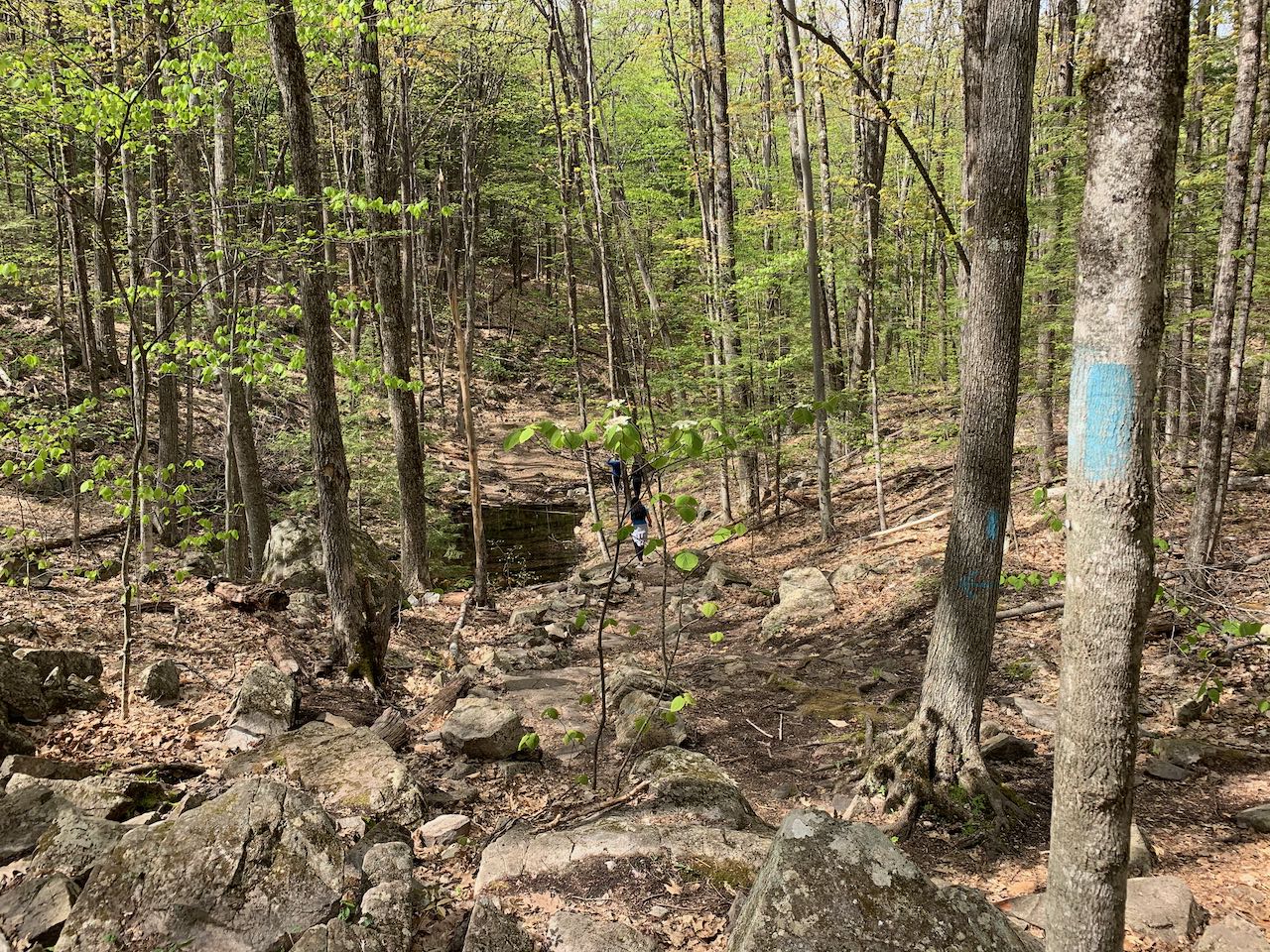
At a trail sign, follow a short path on the right to another great viewpoint, this one oriented more to the north. From here, you have a less-restricted view over the trees, which presents the full extent of the Sandwich Range in addition to much more to the west. Just to the left of the Sandwich Range is the lower Squam Range, with several mountains of uniform height. To the left of this in the distance you can see Mt. Moosilauke. Furthest to the left is the long ridge of Carr Mountain. Continuing on the path, walk through the clearing and arrive at the highest point, near the medium-sized communications tower. You'll see a sign for the Quarry Trail, your descent route, to the left of the tower, but follow one more path to the right out to a large block of ledge with a more intimate view of the nearby hillside, with Belknap Mountain, Gunstock Mountain, and Mt. Rowe in the background. After admiring this one last vista, take the Quarry Trail as it heads through the bright forest on top of the hill for 0.1 miles, then swings right and descends along a small ridge featuring more impressive hemlocks. The trail flattens out after 0.2 miles and makes a meandering bend around the col between Lockes Hill and the unnamed hill just to the south with the neighborhood. After another 0.3 miles through level terrain, the trail passes a spring and descends through a stony area to pass the submerged pit from the old stone quarry that gave this trail its name. The trail continues to descend through the valley of a small stream, eventually widening out and becoming more open as it leads 0.4 miles back to the parking area.
Printable directions page